AIS Updates and Thoughts
After two major collisions with substantial loss of American lives between US Navy destroyers and merchant ships, many of us went to websites that provide histories of the movements of the ships in the area up to the minute of the collision. Using the AIS transponders that are on all of the commercial vessels, and some of the recreational vessels, you can clearly see the paths of the vessels heading in and out of some of the most constrained and confusing waterways in the world. It seems like it would be possible to assign blame solely on the evidence provided by the AIS tracks of the vessels, since the vessels’ speed, course, position, rate of turn, and other information is known on a nearly continuous basis.
If you examine the tracks of the vessels headed into and out of Singapore on August 21, virtually all of the vessels appear to be following the traffic separation scheme that restricts where vessels can operate. It appears to be an orderly 10-knot flow of ships towards and away from one of the world’s busiest harbors. Alnic MC, the tanker involved in the collision, is headed SW at a speed of just under 10 knots when she suddenly turns to port and grinds to a halt. The problem with understanding this collision, however, is that you cannot see the track of the 600’ vessel that she had collided with because the USS John S. McCain is not transmitting her AIS information, in accordance with US Navy policy. https://gcaptain.com/uss-john-s-mccain-collision-ais-animation-shows-tankers-track-during-collision/
Just as not using your radar when operating in restricted visibility is bad seamanship, will we consider the non-use of AIS to be bad seamanship in the near future?
I’ll leave it to the maritime attorneys and professional mariners to determine who is at fault, but my point is that we’ve come to rely on tools new electronic tools, and especially AIS, to understand the moments that led up to a collision, or a grounding, or a near miss. Just as not using your radar when operating in restricted visibility is bad seamanship, will we consider the non-use of AIS to be bad seamanship in the near future?
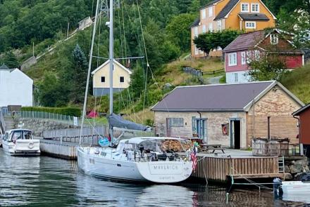
Incidentally, we have been used to dividing the world of AIS products into three broad classes: Class A for commercial vessels (primarily), Class B for recreational vessels who want to be seen by others, and Receive-only models that allow you to see others but not vice-versa. Recently an additional class of product has become available, known by the initials Class B SO-TDMA, which uses some of the more sophisticated technology (SO=Self Organizing) to decide when to transmit like the Class A models, but which does not require a dedicated display. The advantage is that this new class of AIS transmits at a higher power (5W) and, depending on the vessel’s speed, as frequently as every 5 seconds.
endless hours were spent seeing which boat was creeping ahead or behind, based on their AIS transmissions.
Finally, AIS is widely debated by Organizing Authorities of races as to whether it should be used by everyone, used under certain conditions, or be allowed to be turned off for periods of time as a tactical tool. This will no doubt be debated like the use of GPS, autopilots, and external weather routing services have been in the past. What is for certain is how this has changed racing on those events that require AIS to be used. During a stopover in the Volvo Ocean Race in 2014, I was privileged to tour the Volvo 65 Alvamedica in Abu Dhabi. The boat had a 7” multipurpose display that could show all sorts of navigation information, including radar, GPS information, depth, wind speeds, etc. According to the navigator, though, the display was virtually always showing the positions of the other competitors, and endless hours were spent seeing which boat was creeping ahead or behind, based on their AIS transmissions. We’ll have to leave it to the Organizing Authorities to decide if this is how they think navigators should spend their time, especially during 30,000-mile races.